We are
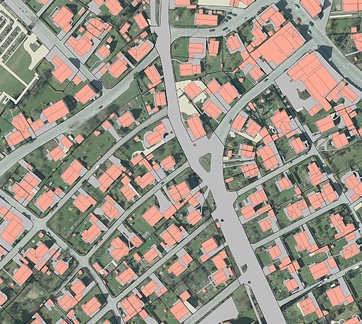
Geospatial and Civil Structural
Specialists

We provide a complete solution for Geospatial Services and Civil Engineering Services at its excellence. Our dedicated & skilled Professionals along with best of infrastructure, technologies to provide best-in-class services.

What we do

LiDAR / Photogrammetry

Echometrix strives high quality in LiDAR data processing and mapping services on point cloud data from Aerial/ Mobile /Terrestrial Platforms and Photogrammetry mapping to meet client requirements and expectations.

GIS / CAD

Our GIS team is expertise in managing, maintaining and execute full range of services necessary for creating database and customizing the data for its various needs. Our qualified Engineers and draftsmen who have extensive experience to convert your Paper to CAD conversion, seamlessly and map into a highly accurate digital files, as per clients required layering standards and any other instructions maintaining dimension accuracy.

Civil Structures

Our structural engineering division offers professional consultancy and design services on civil structural designing of high-rise residential / commercial buildings, industrial structures, foundation designing and much more.

Contact Us

Show Up

Adress: 12/267-D1, CLRA 70, Krishna Kripa

Kodamkulangara, Tripunithura, Eranakulam

Kerala-682301

Ph: +91 97446 09055

E-mail: info[at]echometrix.in


Contact Us